Note: If no download links are given to download a map, clicking on the map’s thumbnail will take you to the original full sized version. Links are only provided when more than one version of a map is available.
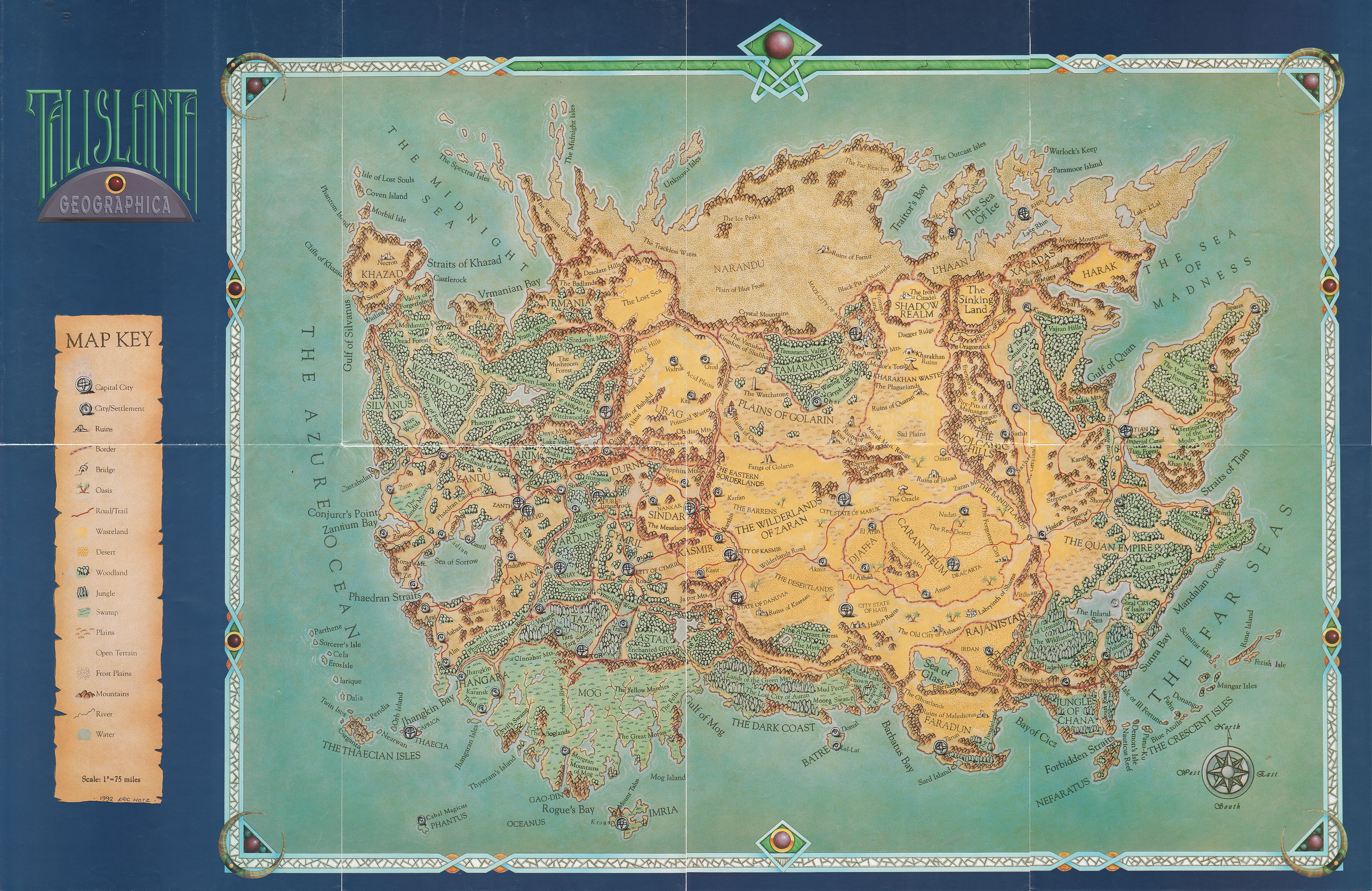
This map was created by Mark Williams. His design is based exclusively upon the map truest to cannon, which graced eight beautiful pages in the 2nd edition Cyclopedia Talislanta, created by none other than Stephan’s wife Patti. Within the book, directly following the map, you will find an extensive index of descriptions for each and every location marked upon the map. This index is now available in a portable, heavily bookmarked, PDF for your browsing pleasure.
Here is the full-color map of Talislanta, by Mark “Tipop” Williams. Each thumbnail links to the full-size image, which range from 1.5 to 4.5 megabytes.
  |
  |
  |
  |
This is the full map. It is 21,000 x 12,000 pixels, 26.6 megabytes. If printed at 600 DPI it will be approximately 3 feet wide and 2 feet high. (It will be twice that size if printed at 300 DPI, which is still pretty sharp.)

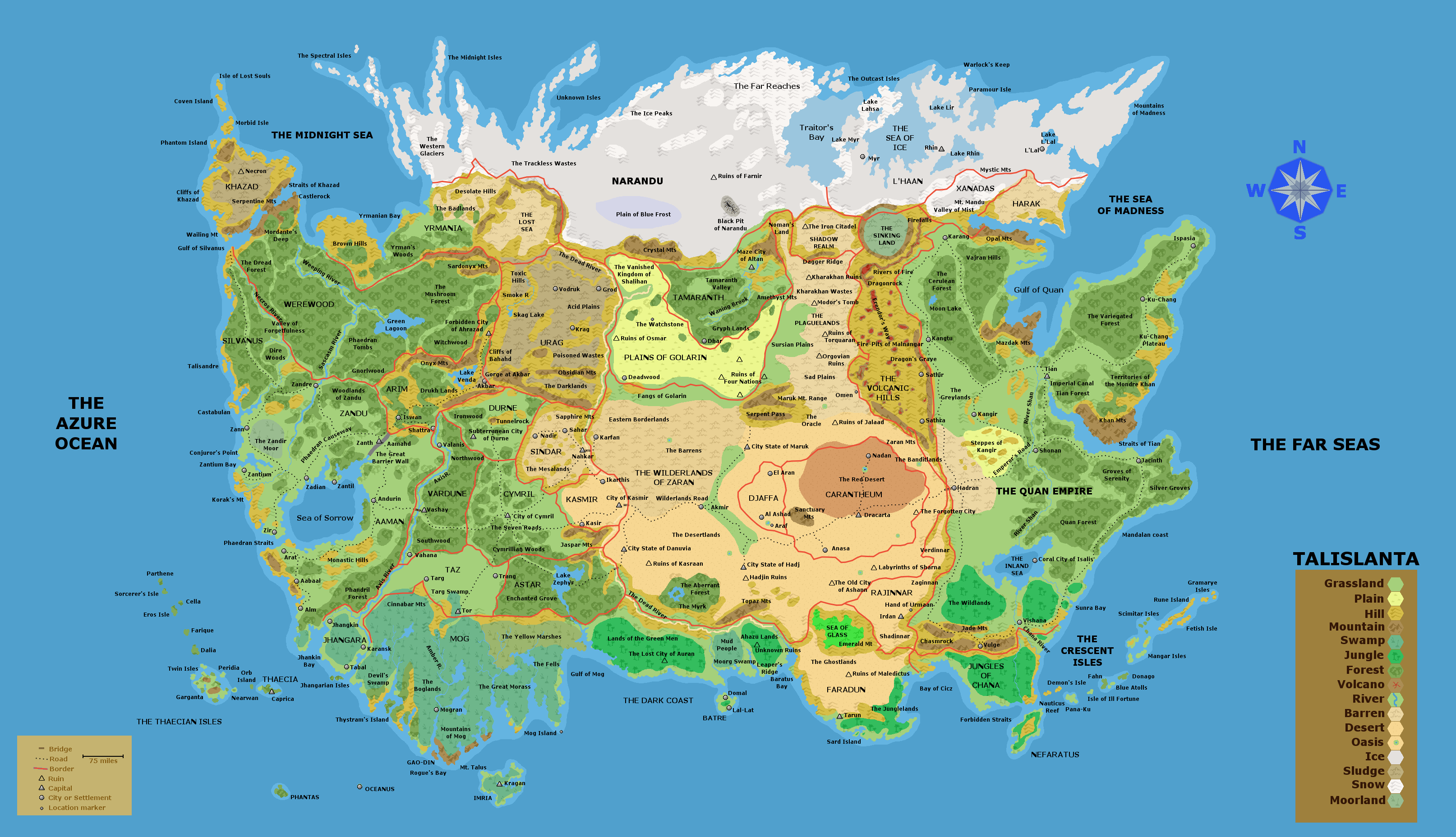
This is the 3rd edition Talislanta World Map, created by Eric Hotz, which was packaged with the Talislanta Geographica. This map comes is available in three different sizes;
72 DPI (2431 x 1580), 150 DPI (5,064 x 3,291), and 300 DPI (10,129 x 6,582).

72 DPI (5.32 MB) – 150 DPI (26.9 MB) – 300 DPI (147 MB)
This is the 2nd edition Talislanta World Map, created by none other than SMS’s wife Patti, which appeared in the Cyclopedia Talislanta. Unlike the other maps on this page this map covered eight pages, back to back, and therefore suffers in the quality department. The scan itself is 150 DPI (4287 x 2767) and when all was said and done the file size was small enough, 24.2 MB, that no further steps were taken to downsample or downsize the map.

This is the custom Talislanta World Map created by Dave L. It is based on Mark Williams map, is 3,228 x 1,857 pixels, and 1.38 megabytes in size. It comes in three versions; no hexes, with hexes, and numbered hexes.

No Hexes (1.38 MB) – With Hexes (1.58 MB) – Numbered Hexes (3.68 MB)

This is the map of the Midnight Realm by Mark Williams. The map that came with the book was converted to black & white for financial reasons. Now you can enjoy the full color version, the way it was meant to be.

Dave L. Maps: These custom maps make it easier to track progress, guague distance quickly, and is ideal for printing out as a handout for players. If you would like to see more of Dave L’s maps or contact him directly you can do so via his Flickr page.
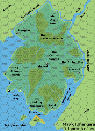
This is the first custom Jhangara Map created by Dave L. There are two sets available; 8 mile hex scale (386 x 529 pixels) and 2 mile hex scale (1,546 x 2,113 pixels). Each set is composed of three versions; no hexes, with hexes, and numbered hexes.

8m, No Hexes (55.8 KB) – 8m, With Hexes (65.8 KB) – 8m, Numbered Hexes (91 KB)
2m, No Hexes (370 KB) – 2m, With Hexes (455 KB) – 2m, Numbered Hexes (1.35 MB)
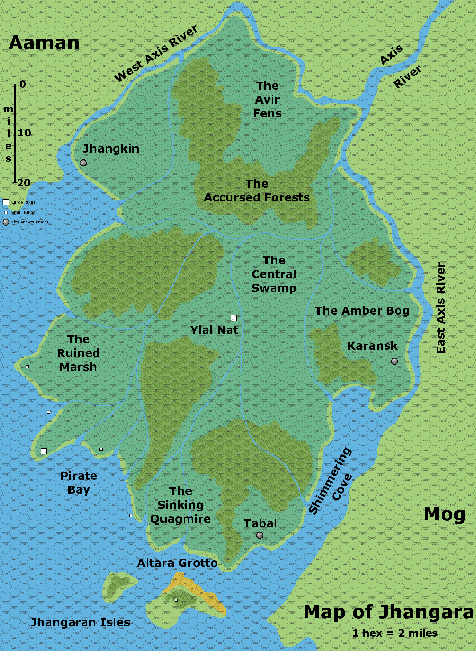
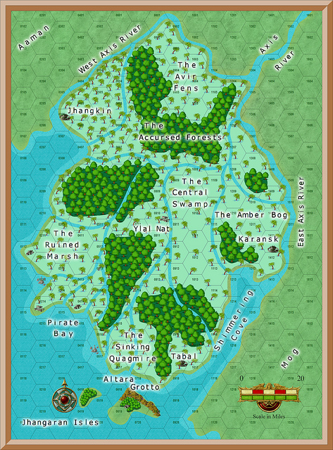
This is the second custom Jhangara Map created by Dave L. It is available in three versions; no hexes, 2m hexes, and 8m hexes. Each map is available in three different sizes; 473 x 640, 757 x 1024, and 1911 x 2585.

473 x 640: No Hexes (299 KB) – 2m Hexes (359 KB) – 8m Hexes (328 KB)
757 x 1024: No Hexes (643 KB) – 2m Hexes (827 KB) – 8m Hexes (721 KB)
1911 x 2585: No Hexes (5.45 MB) – 2m Hexes (6.36 MB) – 8m Hexes (5.75 MB)
The standard coin throughout most of Talislanta is the Gold Lumen. This is primarily based on the fact that the Seven Kingdoms helped establish modern trade routes, so their coin became the de facto standard against which other currencies were evaluated. What you see here are the seven varieties of the Lumen, one for each of the Seven Kingdoms. The coin in the upper-left corner is the default face of the coin, which each nation providing a different back.

The Talislanta RPG and setting, and the Midnight Realm setting, are © 2010 by Stephan Michael Sechi (SMS). All rights reserved. Used by permission.